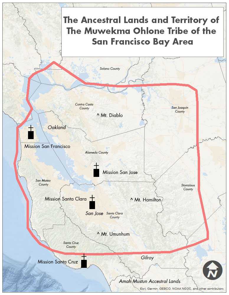
Maps
Tribal History
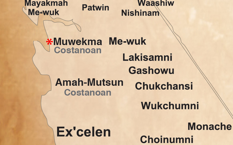
Muwekma Costanoan found on the
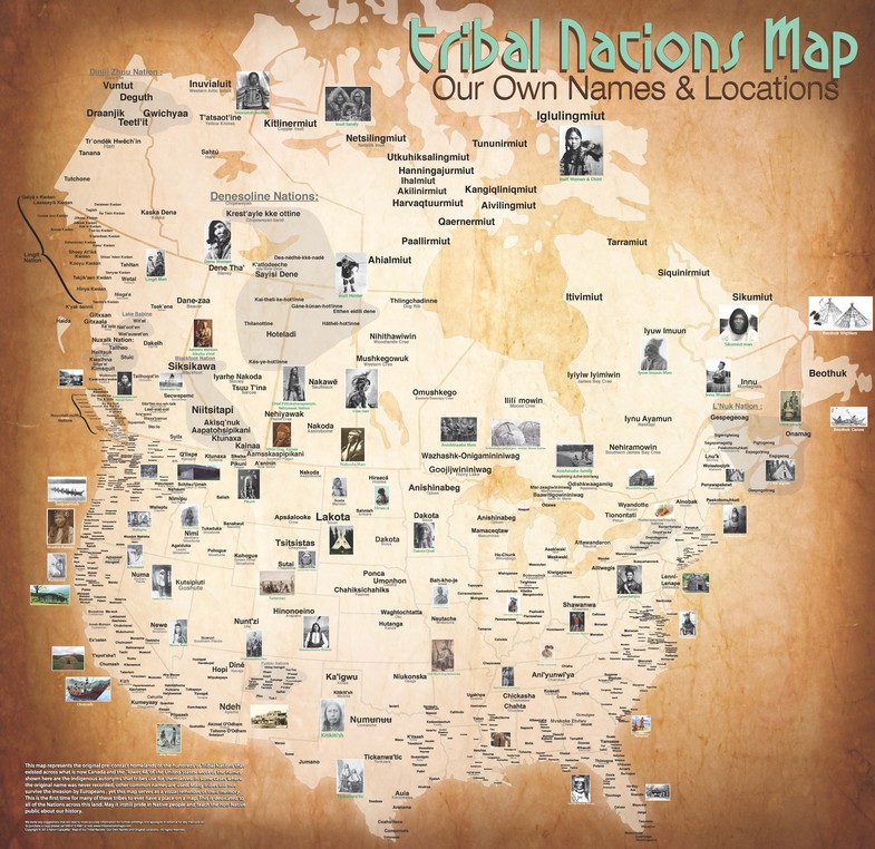
Tribal Nations Map – Our Own Names and Locations!
“This map represents the original pre-contact homelands of the hundreds of Tribal Nations that existed across what is now Canada and the “lower 48” of the United States. Most of the names shown here are the indigenous autonyms that tribes used for themselves. In some cases where the original name was never recorded, other common names are used. Many tribes did not survive the invasion by Europeans, yet this map serves as a visual reminder of their memory. This is the first time for many of these tribes to ever have a place on a map. This is dedicated to all the Nations across this land. May it instill pride in Native people and teach the non-Native public about our history.”
To purchase a copy please call 949-415-4981 or visit:
Copyright © 2013 Aaron Carapella – Map of our Tribal Nations:
Our Own Names and Original Locations – All rights reserved.
View the Full Map at: http://www.npr.org/assets/news/2014/06/Tribal_Nations_Map_NA.pdf
Read the Full Article:
The Map of Native American Tribes You’ve Never Seen Before
By Hansi Lo Wang
June 24, 2014
The Invasion of America
How the United States Took Over an Eighth of the World
View Interactive Map at:
http://invasionofamerica.ehistory.org/
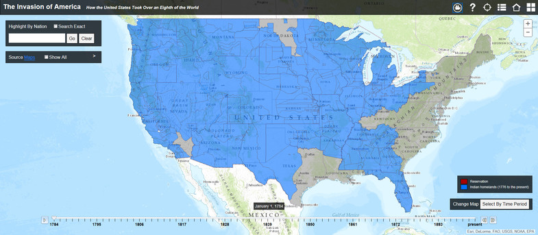
The Invasion of America - How the United States Took Over an Eighth of the World - Interactive Map
The Invasion of America
Between 1776 and 1887, the United States seized over 1.5 billion acres from America's indigenous people by treaty and executive order. Explore how in this interactive map of every Native American land cession during that period.
To learn more about America in 1776
View Interactive Map at: